
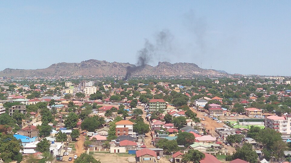
Juba
South SudanPhoto: Rigan123 · CC BY-SA 4.0 · Wikimedia Commons ↗
Juba
South Sudan
Juba is the capital and largest city of South Sudan. The city is situated on the White Nile and also serves as the capital of the Central Equatoria State. It is the most recently declared national capital and had a population of 525,953 in 2017. It has an area of 52 km2, with the metropolitan area covering 336 km2.
Excerpt from Wikipedia, CC BY-SA 4.0 · Read the article →
- Country
- South Sudan
- Population
- 111,975
- Latitude
- 4.83° N
- Longitude
- 31.58° E
Which way is Juba from…
From Paris, Juba lies at 141° to the south-east, 5,620 km as the crow flies.
| Paris | 141° south-east | 5,620 km |
|---|---|---|
| London | 139° south-east | 5,959 km |
| New York | 76° east | 10,954 km |
| Madrid | 129° south-east | 5,297 km |
| Rome | 150° south-east | 4,536 km |
| Montreal | 76° east | 10,790 km |
| Saint-Denis, Réunion | 315° north-west | 3,867 km |
Bearings as the crow flies (great circle), measured from north. From somewhere else, the bearing changes: that’s the whole game.
Oùcécap’s take
South Sudan’s capital lines up with Cairo: from there, Juba is due south, at 179°, 2,805 km away. From London, aim south-east, at 139°, for 5,959 km. Juba also shares its latitude with Bogotá. From New York, a flat map would aim at 111°, south of east; the compass at 76°, north of east.
141° from Paris
Find Juba with your compass
Wherever you are, aim at it with your iPhone: Oùcécap tells you how many degrees off you were.

Scan with your iPhone camera
Which maps?
More destinations to aim at
All destinations A–Z →

Find it with your compass
Free on iPhone. Gather your crew tonight and find out who has the best sense of direction.
Scan with your iPhone camera